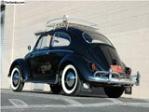
After filling the tank (seems to be around 40 litres) in George yesterday morning, I took the gravel road of the Montagu Pass, which runs on the other side of cliff between it and the wide-laned and tarred Outeniqua pass, over the Outeniqua Pass. While still in school, I often rode this Pass out with the mountain bike, and have also crossed it twice in the past with HW1 - the first time in its blue livery and the second time (in pouring rain) after I had repainted it orange.
From the web:
In 1843 Major Mitchell, Surveyor General of the Cape, suggested that convict labour be used to build a good road over the Outeniqua Mountains, the one which was to be called the Montagu Pass. This was approved by the Hon. John Montagu, Colonial Secretary, and in 1844 work was started on the new pass. About 250 convicts tackled the arduous task of building the new road. They were housed in two camps, the South station and the North Station. The job was completed at a cost of R71 000-00. In 1847 the pass was opened for traffic, but the official opening only took place on 19 January 1948. This was a festive affair, and the Hon. John Montagu personally opened the pass which was to be called after him.
The passage over the mountains, which used to take a full three days over the tortuous Cradock Pass, could now be accomplished within three hours (Today it hardly takes 15 minutes by car).

But there was no rain yesterday, in spite of some cloud cover over the mountains, and at the foot of the Montagu Pass I took this pic at the old toll house (luckily crossing the pass in the 21th century is for free). This is where they shot that old 'glass and a half of milk' Cadbury chocolate TV ad in the early 80's - giving the impression that it was at the Swiss Alps.

Originally the toll was one penny per wheel and one penny per ox. After the Tollhouse you come to the Montagu Pass Bridge. The older generation knew this as the Keurrivier se Brug - due to the Keurbome which grew here in profusion. The Divisional Council succeeded in having this old stone bridge, so artfully build, declared a National Monument. The whole Montagu Pass has also been declared a National Monument and the signposts marking the historic spots along the way were erected by the Divisional Council at the suggestion of the George Museum Society.
The vicinity of the bridge is supposed to be haunted by a man in a grey suit. Having crossed the bridge, you now approach the pass proper, with its stone wall all along the one side. The wall has unfortunately been badly damaged in parts. You will notice that on some parts of the wall the lower row of stone protrude slightly. This was done to prevent the axles of the wagons from scraping against the walls and thus becoming damaged.
The road up the pass is rather narrow and wagons could not pass abreast. Consequently the old drivers had to whistle and shout and crack their whips continuously to warn one another of their approach. The narrowest part of the pass with overhanging cliffs was called Die Noute. Going up the pass you will notice a huge rock to the left, just off the road. This is called Moertjieklip. According to the old-timers this rock was dislodged during the building of the railway line higher up (some maintain it was during the building of the pass itself). It rolled down the mountainside, pinning one of the labourers underneath and crushing him to death. One has to know Afrikaans in order to appreciated the aptness - rather rough humour of the name Moertjieklip. The next place you come to is Boshoff se Draai. According to the late Mr Beb de Swardt a certain Boshoff used to tell all and sundry what a good "touleier" he was. Leading a span of oxen was of course quite an art, it needed exact timing and deft manipulation to manoeuvre a wagon and span round a bend. Then one day the bragging Boshoff miscalculated this particular bend in the road with the result that he landed on the horns of the foreox and was tossed over the wall. After this you find to the left, the ruins of the old smithy. When most of the little buildings were still standing, the Museum Society recommended that it be declared a National Monument.
This was done, but before restoration could be tackled, trespassers had carted away most of the stones. So today we are left with only the ruins of the old smithy. Here the implements used in the building of the pass were sharpened and repaired. Convicts working on the pass were also stationed here under guard.
Now follows the Haarkantdraai - the bend where the road curves towards the right. Next you come to that part of the pass which taxed every poor beast ascending the pass to its utmost, namely the Regoptrek. This is the steepest part of the road. Having mastered this, the old-timers allowed themselves to relax for a while at Grog- Draai. The name speaks for itself. For those not in need of a strong sustenance, there was always the lovely cool water from a bubbling spring nearby.
Then you come to the Hotkantdraai where the road curves towards the left, and to Witkop se Draai from where you have a view of the white koppie. The name, Witkop se Draai, alludes to the colour of the soil. Where the road passes underneath the railway bridge, you have Stinkhoutdraai. Stinkwood trees used to grow here in profusion. Further along the road, on the right, we find the old wagon tracks cut into the stone by the wheels and remskoene (brakes) of the wagons descending from the old Cradock Pass.
And then at last, you reach the hotel at North Station. The oldest part of the ruins probably dates from approximately 1840, i.e. before the building of the Montagu Pass, and housed visitors from the days of the Cradock Pass.


The old railway bridge, a few hundred metres before you reach the highest point on the Pass about 900metres above sea level

On the other side of the Montagu Pass, and with a much more relaxed gradient, I went down to the small town of Herold. Here the gravel road became a tarred road again, and I proceeded to the T-junction with the N9, where I turned left (right is towards Uniondale and Willowmore, part of which we used for this year's George Tour.)
After a brief few kms on the N9, I joined the N12 again and headed North for the Klein Karoo Town of Oudtshoorn, ostrich country.

Through Oudtshoorn, I carried on North towards the Cango Caves, in the distance the mighty Swartberg Mountais were waiting..

The road turned into gravel once again, with several warnings like these:

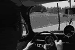
The ascent started, and the old lady just carried on in second gear, with the occasional backshift to first

The view to the left of the Klein Karoo and the Oudtshoorn/Caltizdorp area was breathtaking

From the web:
The Swartberg mountains (black mountain in Afrikaans) make up a mountain range that runs roughly east-west along the northern edge of the semi-arid area called the Little Karoo in the Western Cape province of South Africa. To the north of the range lies the other large semi-arid area in South Africa, the Great Karoo.
There are several passes through the Swartberg Range, the most famous of which is possibly the Swartberg Pass that runs between Oudtshoorn in the south and Prince Albert in the north. The pass is not tarred and can be a little treacherous after rain, but offers spectacular views over the Little Karoo and the Great Karoo to the north. The plant life along the pass is particularly interesting, many hundreds of species being found on the Swartberg, as is the drystone work supporting some of its picturesque hairpin bends.
Much of the Swartberg is part of a UNESCO World Heritage Site.
The Swartberg Pass between Prince Albert and Oudtshoorn was officially opened on January 10, 1888. This masterpiece of engineering is the last of seventeen passes built by the famous road builder and engineer, Thomas Charles Bain (1830 – 1893), in the Cape Province. It was built by means of convict labour and can undoubtedly be seen as the most spectacular pass in South Africa. There are various places of interest along he Pass of which most are indicated by signposts.

At the top of the Pass

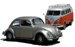
Gamkaskloof ('The Hell') turnoff - next time I will go there with HW2!


On the other side of the Swartberg Pass, heading for Prince Albert, one finds this amazing piece of engineering. The road is really very steep here, and I won't try to cross the Pass from this side in any other ACVW than an SWB Buggy...This road sign indicates the turnoff to the Otto du Plessis Road leading to Gamkaskloof, also known as The Hell. This remote and isolated valley is of great ecological, archaeological, historical and cultural value. A small secluded farming community, well known for their delicious dried fruit, used to live in Gamkaskloof which could only be reached by foot before the completion of the Otto du Plessis Road in 1962. This road actually led to the demise of the farming community and today the depopulated valley forms part of the Swartberg Nature Reserve. Apart from some restored historical homes, which serves as tourist accommodation, it is sad to say that much of the unique cultural heritage and tourism potential of Gamkaskloof is currently being lost due to an outdated approach by the relevant conservation authorities by focusing primarily on protecting the biological environment


The rule of thumb for crossing any single-track mountain pass:

Successfully over the pass, I joined the tar road heading to the small town of Prince Albert.

Got a coldrink and some biltong in Prince Albert, and carried on to the N1, where I passed through Leeu-Gamka, Beaufort West and Three Sister. About 30km from Three Sisters, the Variant suddenly started to loose power. At the Shell Ultra City I filled up again, opened the engine and saw the cause of it - the link of the right-hand side Solex came loose, in other words the car was only running on two cylinders. Quick fix, although it happend a few times again, and I could carry on. Shortly after Three Sisters, I turned off from the N1, taking the N12 through Victoria-West, Britstown, Strydenburg, Hopetown and Kimberley. Took this pic of the long, straight Karoo road, just before dark.

Went through Kimberley, Warrenton, Christiana and Bloemhof till I got to Wolmaransstad. It was now an hour after midnight, and I was really tired. Slept in the car till early this morning (freezing cold, I forgot to take a blanket
After an early morning coffee, facewash, and toothbrush I was ready for the road again. Went through Klerksdorp, and turned off for a quick visit to IMPI in Orkney. Had a nice breakfast and coffee there (thanks for the exhaust, Armand!
The car went really very well - and it seems like I got a fuel consumption of between 10 - 11 kms/liter over a distance of more than 1300km at speeds between 100 and 110km/h. I had to add 500ml of oil (moist valve cover might be the cause of this), which is totally normal for any aircooled. In spite of putting in LRP petrol, and two bottles of Penn's Valve Ease, the exhaust had this healthy colour when I arrived home:

Thanks to the Almighty for a very safe journey, and thanks to all of you for your support! So who is joining us for the 2010 George Tour?